ಚಿತ್ರ:KGeography 1 Map of undivided Andhra Pradesh.png
Jump to navigation
Jump to search


ಈ ಮುನ್ನೋಟ ಗಾತ್ರ:೮೦೦ × ೪೨೧ ಪಿಕ್ಸೆಲ್ಗಳು. ಇತರೆresolutions: ೩೨೦ × ೧೬೮ ಪಿಕ್ಸೆಲ್ಗಳು | ೬೪೦ × ೩೩೬ ಪಿಕ್ಸೆಲ್ಗಳು | ೧,೩೬೨ × ೭೧೬ ಪಿಕ್ಸೆಲ್ಗಳು.
ಮೂಲ ಕಡತ (೧,೩೬೨ × ೭೧೬ ಚಿತ್ರಬಿಂದು, ಫೈಲಿನ ಗಾತ್ರ: ೬೬ KB, MIME ಪ್ರಕಾರ: image/png)
Summary
| Description |
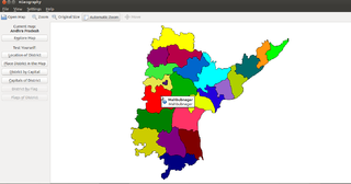
English: Map of undivided Andhra Pradesh shown in KGeography
|
| Date | |
| Source | https://commons.wikimedia.org/wiki/File:KGeography_1_Map_of_undivided_Andhra_Pradesh.png |
| Author | Albert Astals Cid and Developers |
Licensing

|
Permission is granted to copy, distribute and/or modify this document according to the terms in Creative Commons License, Attribution-ShareAlike 4.0. The full text of this license may be found here: CC by-sa 4.0 |
ಕಡತದ ಇತಿಹಾಸ
ದಿನ/ಕಾಲ ಒತ್ತಿದರೆ ಆ ಸಮಯದಲ್ಲಿ ಈ ಕಡತದ ವಸ್ತುಸ್ಥಿತಿ ತೋರುತ್ತದೆ.
| ದಿನ/ಕಾಲ | ಕಿರುನೋಟ | ಆಯಾಮಗಳು | ಸದಸ್ಯ | ಟಿಪ್ಪಣಿ | |
|---|---|---|---|---|---|
| ಪ್ರಸಕ್ತ | ೧೦:೫೬, ೨೧ ಡಿಸೆಂಬರ್ ೨೦೧೬ | | ೧,೩೬೨ × ೭೧೬ (೬೬ KB) | Venkatesh | {{Information |Description ={{en|1=Map of undivided Andhra Pradesh shown in KGeography}} |Source =https://commons.wikimedia.org/wiki/File:KGeography_1_Map_of_undivided_Andhra_Pradesh.png |Author =Albert Astals Cid and Developers |Dat... |
ಕಡತ ಬಳಕೆ
ಈ ಕೆಳಗಿನ ಪುಟವು ಈ ಚಿತ್ರಕ್ಕೆ ಸಂಪರ್ಕ ಹೊಂದಿದೆ: