Digital Story Telling GHS Mallapura 2012
|
Name of School |
GHS MALLUPURA, NANJANGUD |
|
Taluk |
NANJANGUD TQ |
|
H.M.'S Name |
NAGENDRA |
|
HM Phone Number |
9845964223 |
|
Number of Students |
|
|
Number of Teachers |
Report on ICT Week at
GHS Mallupura (for 3 days!)
Dec 5 - 7, 2012
Background
As part of our intensive work on the Teachers' Community of Learning, an ICT week was planned at GHS Mallupura, Nanjangud Taluk.
The following were the objectives of this initiative:
- To build school-wide capabilities in the use and integration of ICTs into teaching-learning processes
- Explore new and ICT-enabled methods of transacting subjects that cut across subject lines and make learning relevant and contextual to the students
- Present a model of utilizing the ICT infrastructure in schools for better educational outcomes and administration
Towards
achieving these objectives, the following activities were planned in
the school.
- Mapping the school and the neighbourhood and comparing it with the google maps to understand the idea of map making
- Creating a photo essay of the school and the surroundings
- Meeting with the teachers to plan an ICT integration in the school
- Collecting demographic data about families and their ancestors to document community history
- Presentation of the work by the students
The
detailed concept note with the proposed activities and objectives is
at Annexure. Rakesh, Seema and Ranjani organized and conducted the
event. The following is the summary of the event.
Day 1
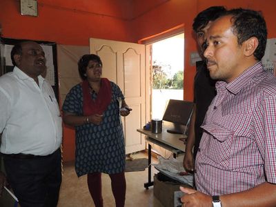
The day 1 started with an introduction to all the teachers. We met the Head Master and all the teachers and Ranjani introduced the ITfC team and took them through the plan of work. It was decided that we would work with Class 9 on Day 1 - on map making. The class of 87 children had already been divided into 5 groups.
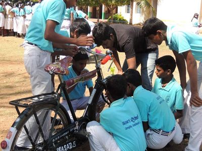
Rajesh (the maths teacher) explained the project of mapping. He explained why we need to have a scale for a map, why there are standards for measurements and we got into a discussion on how to map the various areas. We decided that we would map the school, the roads around and the village and route to the Mallupura sugar factory. The children discussed what possible methods could be used for mapping the compound, the school area and the distances around the village. For the school compound, we decided on ropes and inch tapes and for the outside area, it was decided to measure with cycle wheel rotations! And checked with the motorbike. The students were in 5 groups - three groups of girls were to map the school compound including all the details and the buildings. Two groups of boys were to go for the mapping outside of the school. The boys spent a lot of exciting time trying to measure the wheel rotation. They also attached a sound counter that would help them determine when a wheel rotation was complete. Two wheel rotations were measured to be approximately 2 metres and the students were to go measuring the village.
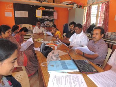
After the initial preparation, Rajesh, Ranjani and Rakesh had to join a meeting with the Head Master, Nanjangud BRP and the nodal officer of NVEQF. The drawing teacher who was trained was also part of the discussions. The timetable and method of selection of the students for the programme were discussed.
It was close about 2.45 pm when the two groups went outside the
school. The three groups of girls were already done with some of the
measurements and we left them with some instructions to make an
initial sketch with the help of the drawing teacher. Ranjani went
with the group around the village and Rakesh went with the group to
the factory. Seema helped the three groups who had been working
inside the school. We ended the day's work at 430 pm. During the
first day, not all the teachers participated. The CBZ teacher and
Rajesh were the only ones with us with the drawing teacher providing
intermittent support.
Day 2
Rakesh, Seema and Ranjani reached the school at 9 am in the morning. The day started with a bit of excitement as we left the office at 640 am in the morning. After two bus rides and a breakfast at Nanjangud (with Seema declaring that the Nanjangud idli was better than Mysore idlis - there were only 5 to a plate!), we reached the school a little before 9.
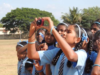
We met the class 9 children and we started to discuss how to put the map together. During the discussions, we discovered that the measurements were wrong because the two sides of the school had different measurements. The students decided to cross-check the bicycle-based measurements. We also discussed why the bicycle-based measurements could have given us the wrong answer. Similarly, the students who made the measurements inside also cross-checked their measurements. After this, we had a session, where they were taken through the google map image of the school and measurement. The students were very eager to spot their houses and we also discussed why the measurements made on the googlemap and the measurements they made differed. Rajesh explained the idea of a scale of a map one more time and discussed the idea of a perspective. We also saw the town of Nanjangud and the distances from the temple as well as neighbouring villages and roads.
We left the students with instructions on how to finish the map. They needed help with measuring and the idea of scale, etc. However seeing the google map gave them an idea of the map. They were able and keen to fill in details.
On the second day, we also had a meeting of all the teachers after
lunch and requested their participation. We also made a plan for
which teachers would start planning their ICT integration for their
subjects. All the teachers went with the Class 8 students, 90 of
them on their photo essay of the village. One group photographed the
school and 4 other groups went around the village photographing. We
decided to do the documentation the next day.
During the second day, Rakesh also fixed the thin clients in the
school. 9 machines were working and we tested. The school does not
have an internet.
The day ended on an equally exciting note as we missed the bus.
The teachers dropped us to Nanjangud on their bikes and then we got
into the bus for Mysore. All of us were completely tired and slept
dreamlessly on the bus!
Day 3
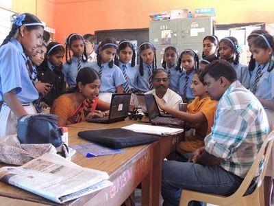
Rakesh had to leave for a family emergency and Seema and Ranjani went to the school. During the previous evening Ranjani had already selected the pictures from each of the teachers that had to be documented and this was given to the anchoring teachers. Each teacher worked with their group and started to document their stories. They did this on our net books as all the children could not be accommodated in the lab and there was some documentation work being done on the server on Windows. The photo documentation took the entire morning. In parallel, the students from Class 9 were completing their map. While a few of them (about 10) were completing the map, the other students from class 9 were revising their lessons.
After lunch we had an extended discussion with the teachers on how and what methods can be used for ICT integration. Initially the teachers all were saying nothing can be done because there were no facilities. After some discussions, when I pointed out that they are essentially saying there is no solution, we focused on what the teachers could do for skill building.
We agreed on the following:
- The headmaster would make a timetable that would allow each subject teacher one period per week of practice time on the computer. Rajesh volunteered to train them initially.
- Between now and February when we would make the next visit, the teachers would develop a plan for which areas/ which lessons they would like to transact using ICTs.
- The school will explore purchasing a laptop from the RMSA funds/ science equipment funds.
After this discussion, we had the Class 8 students make a presentation to the Class 9 students on what they photographed about the village and school. All the teachers were present. This was followed by a presentation of the Class 9 students to the class 8 students about how the map was made and what were the challenges. On Day 3, we also collected the information that the students had collected about their family history.
Our learnings and conclusions
- We were able to complete the mapping and photograph essay. All the elements that we wanted to cover could not be completed for lack of time as well as the fact that we did not have enough teachers with us on the first day. The vegetation and land use mapping got left out, though the children documented various kinds of vegetation. While we managed with the large class sizes, all students would not have gained in the same manner, especially because the documentation (the drawing of the map and the writing of the photo stores were done only by a few). The only way around this seems to be to make more projects and groups with not more than 10 students per group.
- Classroom integration with subjects could not be taken up this time. We had not understood the level of teacher skills as well as the infrastructural challenges. Also, there was not adequate time to plan the classes given that these projects were going on. However, we did make a plan for teachers to practise as well as start looking up curricular resources. Teachers are involved in many non-academic choice which seems both forced as well as by choice.
- This kind of an interaction needs a lot of involvement from our end, both in terms of the effort during the programme as well as for follow up. We need to follow-up on several aspects of this work:
- The timetable for training for teachers
- Interacting with teachers to generate ideas on alternative methods of transacting content that could use ICTs effectively
- Completing the recording of the data collected by the students to help the demographic study
- The next steps are in the following areas:
- Complete the documentation and update the website and share with the school
- Make a follow-up plan on this mapping work - extension into taking up an Open Street Mapping exercise and creating video and audio stories of the village
- Continuous mentoring and support of the school for the teachers in the use of the lab
- Sharing this work with other TCoL schools so that similar projects can be taken up there as well
- Develop a plan for transacting curriculum using ICTs
